Most Popular
-
1
Russia sent more than 165,000 barrels of refined petroleum to N. Korea in March: White House

-
2
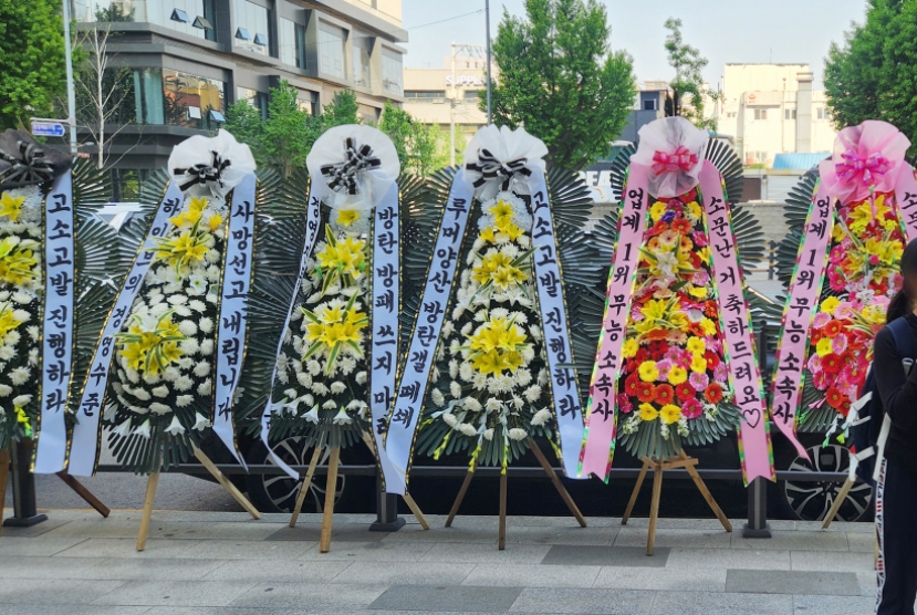
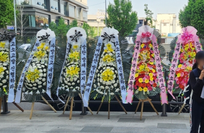
Key suspects grilled over alleged abuse of power in Marine death inquiry

-
3
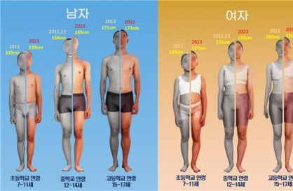
S. Korean children, teens grow taller, mature faster than before: study
-
4
[Graphic News] Number of coffee franchises in S. Korea rises 13%
![[Graphic News] Number of coffee franchises in S. Korea rises 13%](//res.heraldm.com/phpwas/restmb_idxmake.php?idx=644&simg=/content/image/2024/05/02/20240502050817_0.gif&u=)
-
5
Army takes group action against Hybe for neglecting BTS


![[Graphic News] Number of coffee franchises in S. Korea rises 13%](http://res.heraldm.com/phpwas/restmb_idxmake.php?idx=644&simg=/content/image/2024/05/02/20240502050817_0.gif&u=)

-
6
Marine Corps commander summoned by CIO for questioning on alleged influence-peddling case

-
7
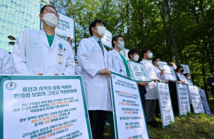
Some junior doctors are returning: Health Ministry
-
8
[Robert J. Fouser] AI changes rationale for learning languages
![[Robert J. Fouser] AI changes rationale for learning languages](//res.heraldm.com/phpwas/restmb_idxmake.php?idx=644&simg=/content/image/2024/05/02/20240502050811_0.jpg&u=)
-
9
Ador CEO's request for exclusive right to terminate NewJeans' contract with Hybe refused in February

-
10
Woman dangling from power lines rescued by residents holding blanket


![[Robert J. Fouser] AI changes rationale for learning languages](http://res.heraldm.com/phpwas/restmb_idxmake.php?idx=644&simg=/content/image/2024/05/02/20240502050811_0.jpg&u=)


[Contribution] Weathering severe storms with weather radar
By Korea HeraldPublished : Nov. 9, 2023 - 14:44

By Yoo Hee-dong
According to the 2022 Annual Report on Natural Disasters by the Ministry of the Interior and Safety, 96 heavy rainfall events occurred in South Korea during the summer season between 2012 and 2021, resulting in 1.6 trillion won ($1.2 billion) in property damage and 63 fatalities. Furthermore, last year and this year, unprecedented torrential rainfall caused 3.4 trillion won in property losses and 95 deaths. In just two years, this amount has surpassed the total damage of the past decade. These intense downpours, sometimes referred to as “guerrilla” storms, develop rapidly within a short period of time and on a relatively small scale. They are becoming increasingly severe and violent each year, having a significant impact. Despite continuous improvements in weather forecasting technology, there is still much work to be done in preventing catastrophic damage from increasing severe storms due to the uncertainties associated with climate change.
When cumulonimbus clouds interact and merge, explosively forming a single entity with heavy precipitation covering dozens to hundreds of kilometers, the phenomenon is referred to as a mesoscale convective system (MCS). These systems are a significant source of hazardous weather events on Earth, leading to severe weather phenomena such as intense rainfall, flash floods, hail, lightning and occasionally tornadoes. Given the socioeconomic impact of severe weather events associated with MCSs, numerous meteorologists have invested considerable efforts in understanding their dynamics, thermodynamic characteristics and structure. Throughout this arduous journey, weather radar technology has played a crucial role over the past 80 years as one of the most powerful tools in meteorology for understanding and predicting MCSs.
Intensive observation projects that utilize radar, including three-dimensional scanning, have revealed the characteristic pattern of MCSs, which consists of convective echoes resulting in heavy rain concentrated over localized small areas and stratiform echoes that produce drizzles over a wide expanse. Based on radar data, physical meteorologists have identified a standard life cycle for MCSs, in which gust fronts and a mass of cold air at the boundaries of decaying cumulonimbus clouds trigger the development of new convective cells, leading to the production of stationary heavy precipitation within a narrow region. It is worth noting, however, most of these field experiments and studies have been conducted in the US Midwest and may not fully represent the general characteristics of MCSs around the world.
MCSs in South Korea during the summer period are similar in morphology to general MCSs. But the combination of humid flux, lower level convergence, upper-level baroclinic troughs and the unique topographic characteristics of the Korean Peninsula, with its three seas and rapidly ascending mountainous regions along the east coast, give rise to a distinctive life cycle, from initiation and development to dissipation of MCSs. Radar-based research findings indicate that MCSs over Korea typically travel relatively long distances from the southwest to the northeast along the path of midlatitude storm tracks until June. On the contrary, in July and August, their movement shifts eastward, often originating in the Yellow Sea or on the western coast of Korea. They move over relatively short distances at a slow pace, inducing concentrated, intensive precipitation over a narrow area. In particular, when there is an abundant water vapor flux driven by the well-developed North Pacific subtropical high, MCSs are often embedded in synoptic lows or stationary frontal systems. This situation, in turn, can result in super-extreme heavy rainfall concentrated in a narrow area.
During the summer period, such MCSs can rapidly develop anywhere in Korea, leading to torrential rainfall over very localized areas. This situation highlights the urgent need for prompt information delivery, achieved through close monitoring and forecasting these MCSs, to prevent severe damage from heavy rain. Recently, the Korea Meteorological Administration (KMA) has developed a new technology for tracking the movement and development stages of MCSs from their initiation. This involves incorporating advanced computer vision technology into radar image analysis to quickly and accurately assess the direction and speed of individual convective cells. Specifically, through this technology, the KMA can analyze the movement of strong convective cells associated with heavy rainfall in real-time. This analysis helps identify stationary precipitation areas, enabling the KMA to conduct intensive monitoring of areas at risk and to promptly disseminate information about disaster risk through advisories, warnings, weather updates and emergency disaster text messages.
The KMA will continue to integrate its accumulated radar analysis experience with cutting-edge technologies such as artificial intelligence (AI), satellite observations and high-resolution numerical weather prediction (NWP) models. This approach aims to proactively track the initiation, growth, development and dissipation of MCSs, identifying the risks of heavy rain in advance to better prepare for severe storms. These efforts will contribute to ensuring that the loss of life caused by torrential rain becomes a thing of the past.
Yoo Hee-dong is the director of the Korea Meteorological Administration. -- Ed.
-
Articles by Korea Herald


![[Eye Interview] 'If you live to 100, you might as well be happy,' says 88-year-old bestselling essayist](http://res.heraldm.com/phpwas/restmb_idxmake.php?idx=652&simg=/content/image/2024/05/03/20240503050674_0.jpg&u=)